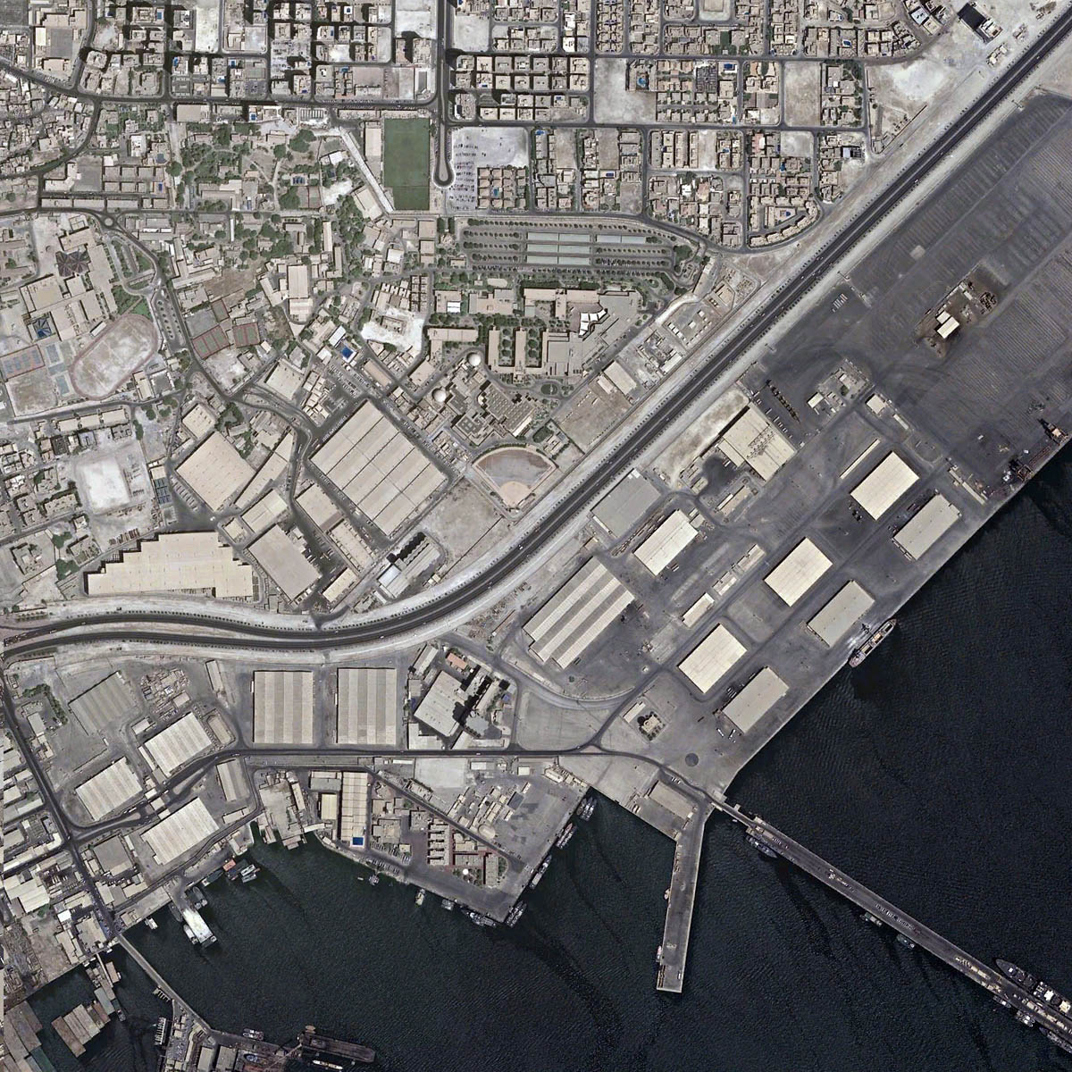
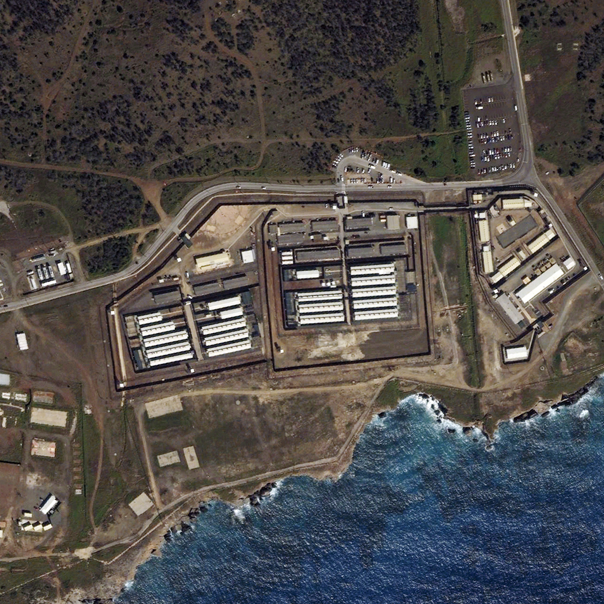
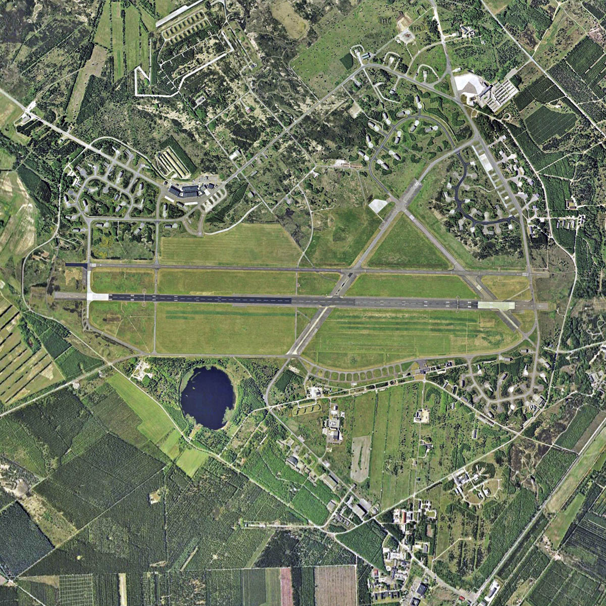
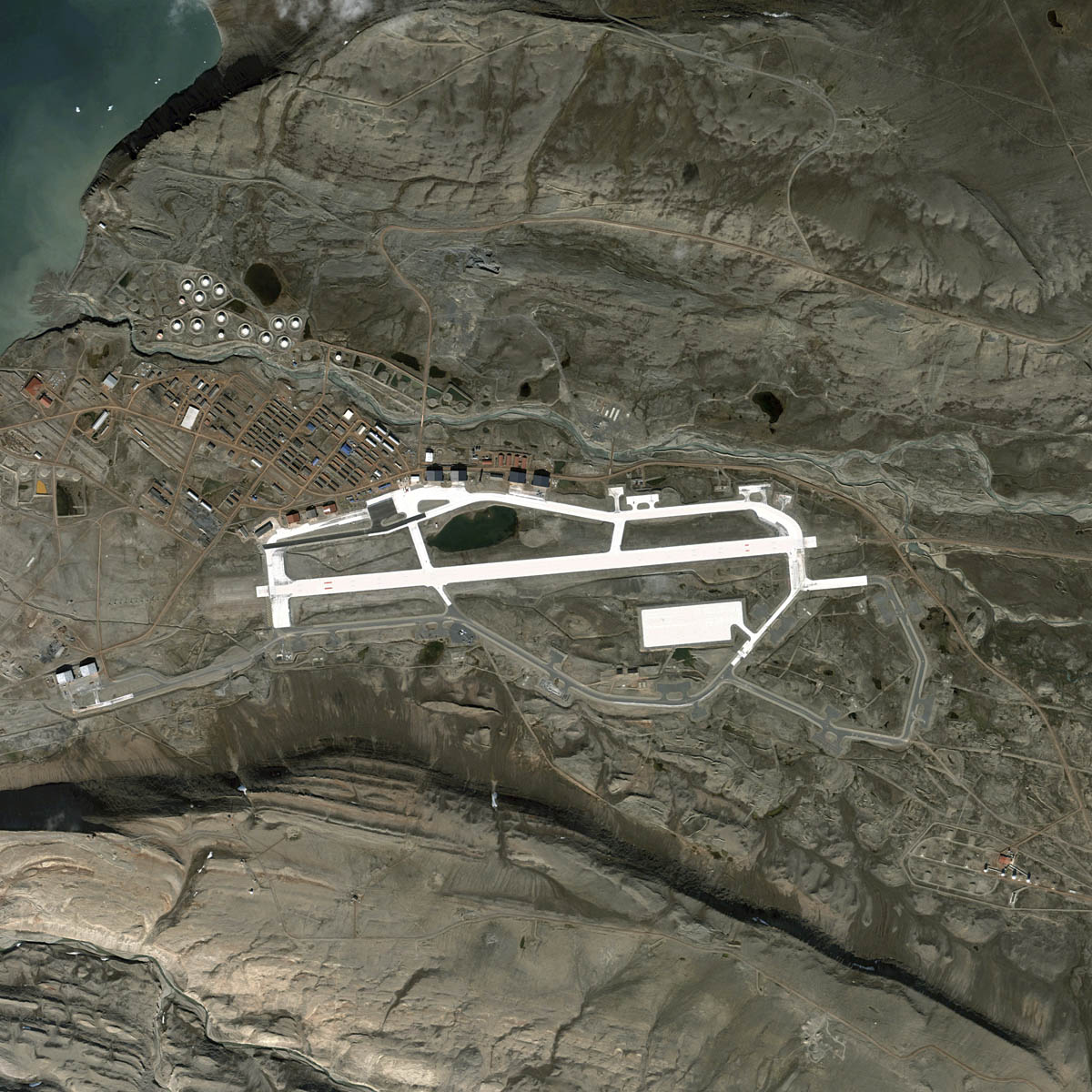
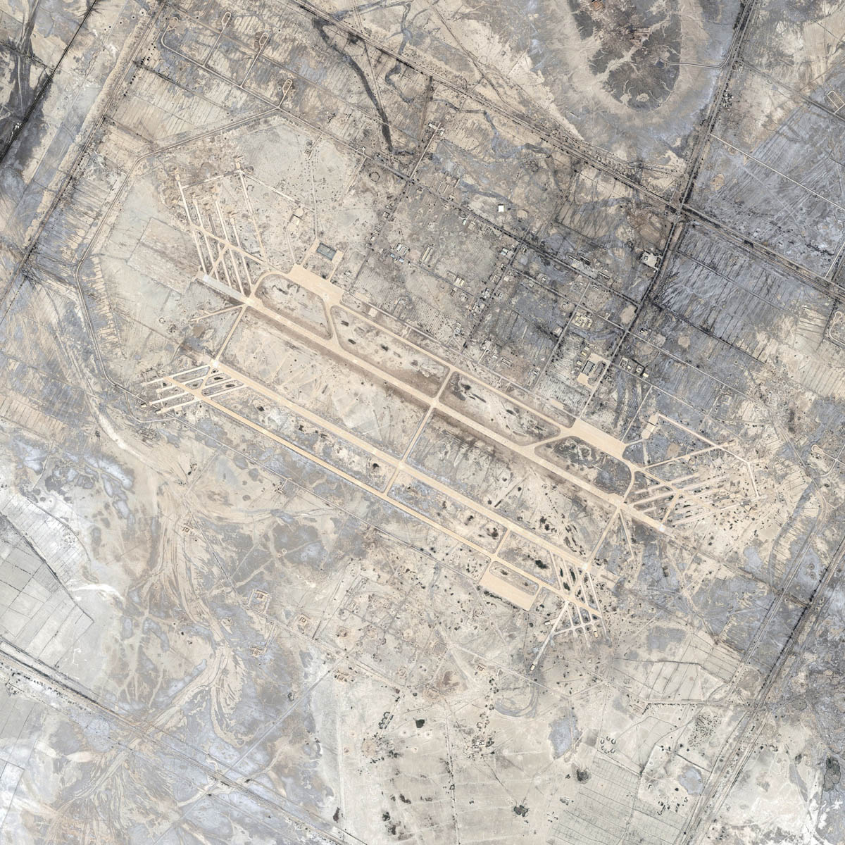
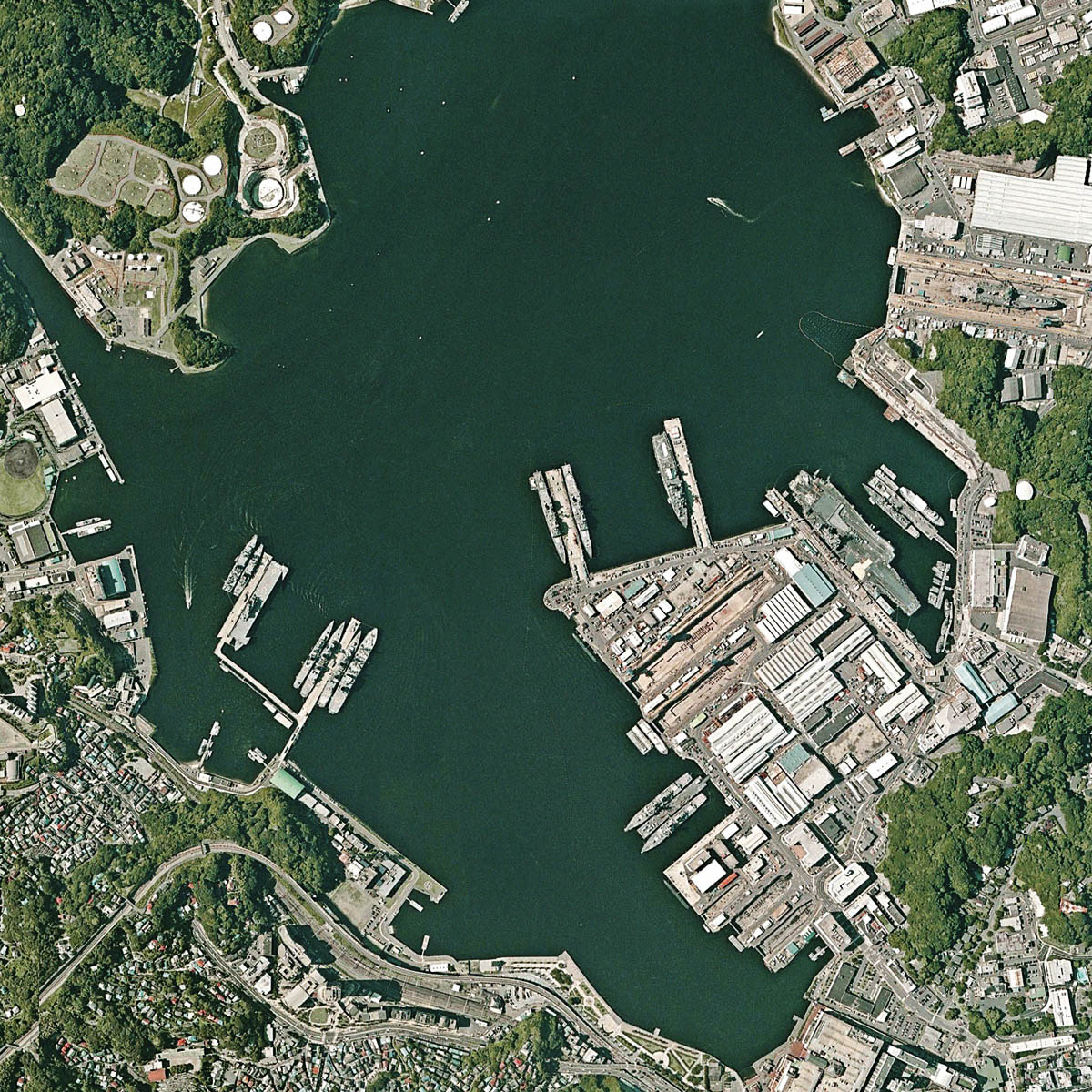
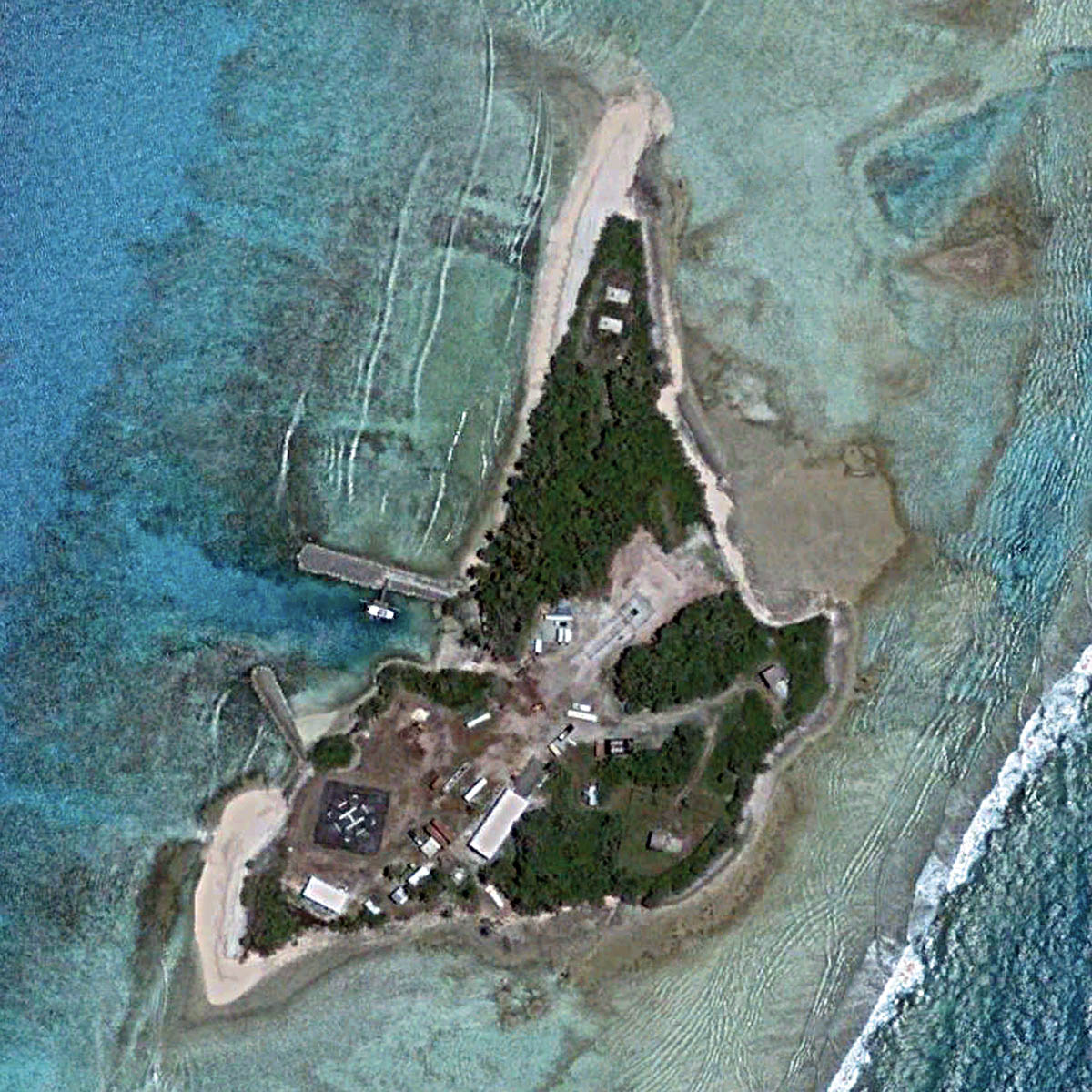
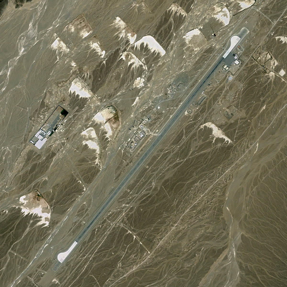
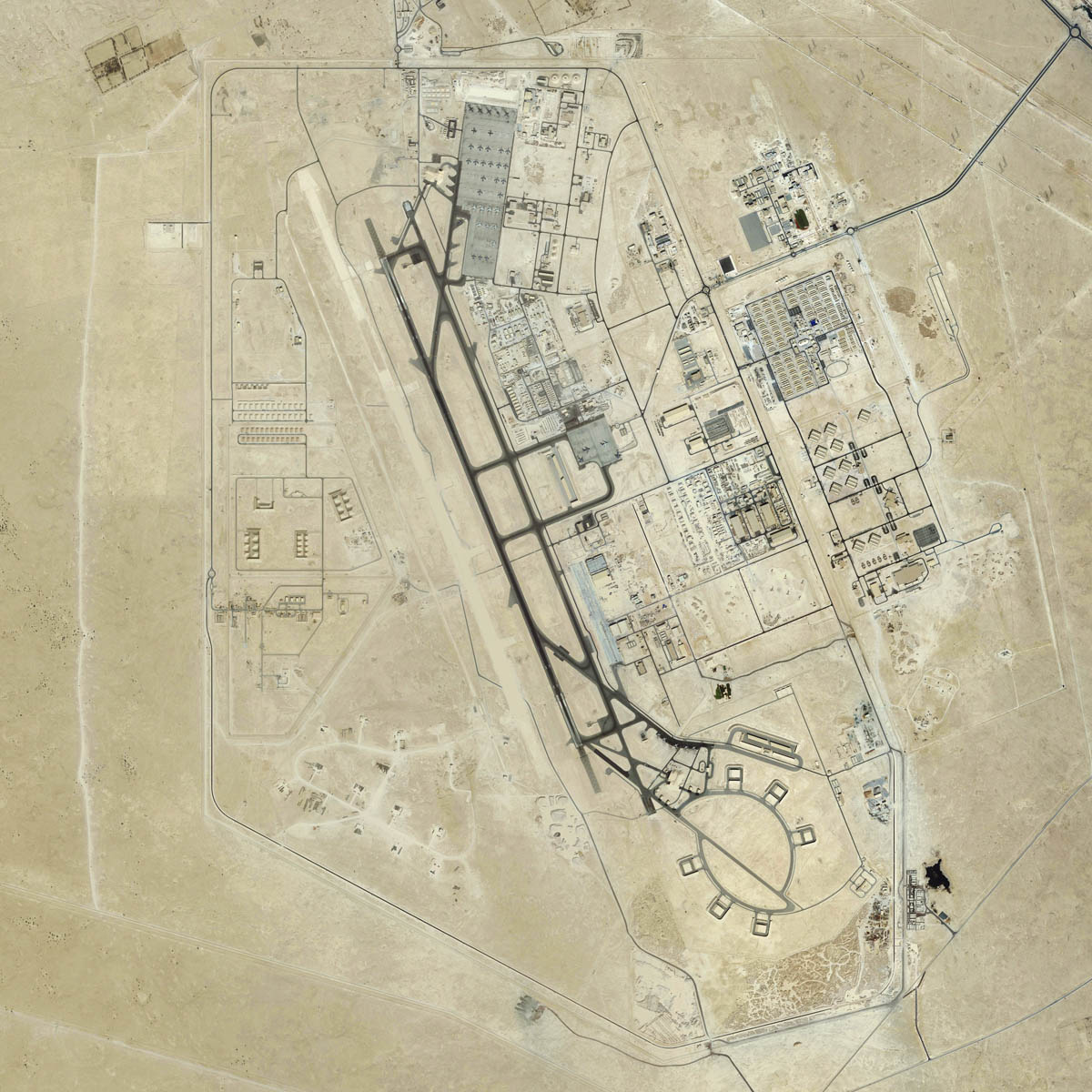
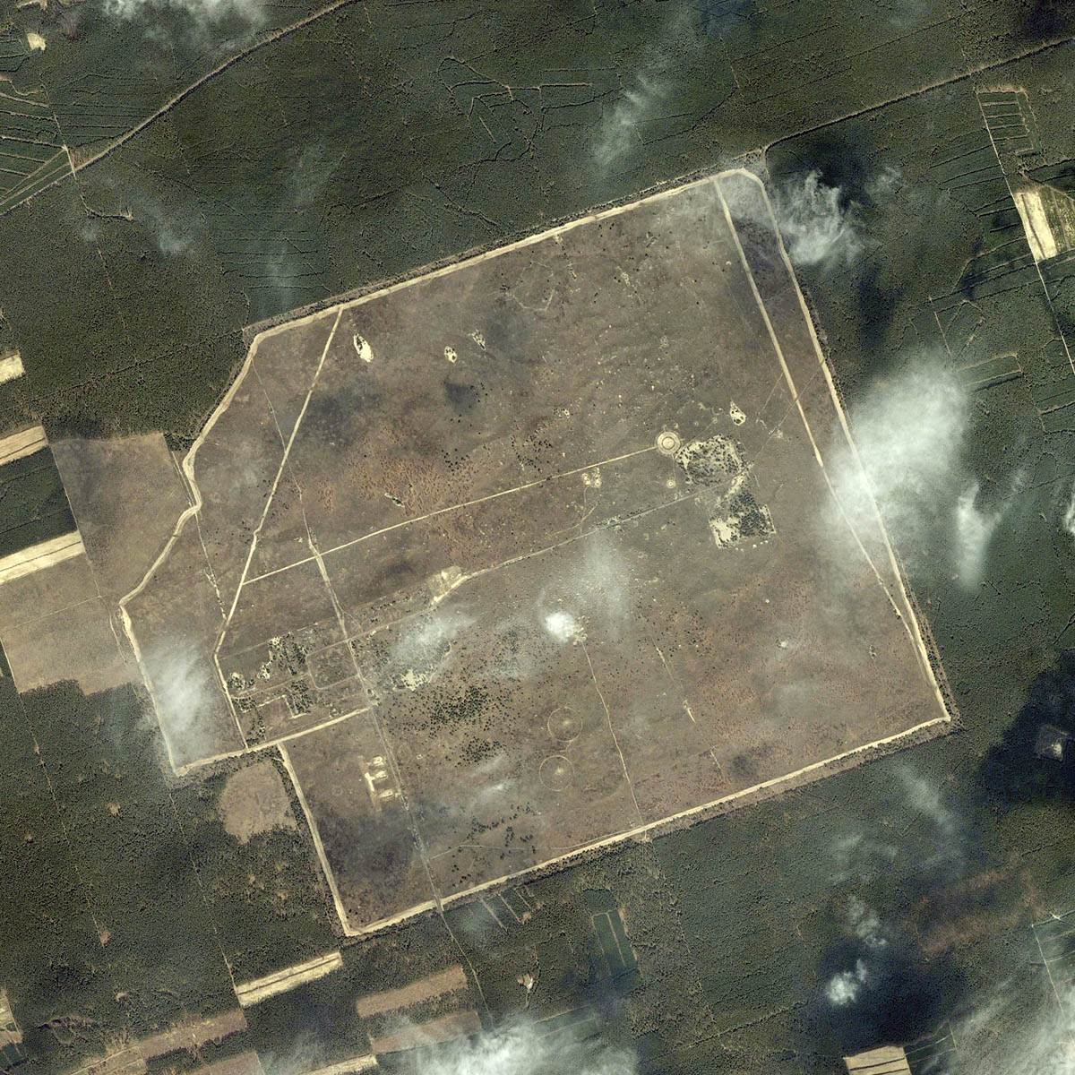
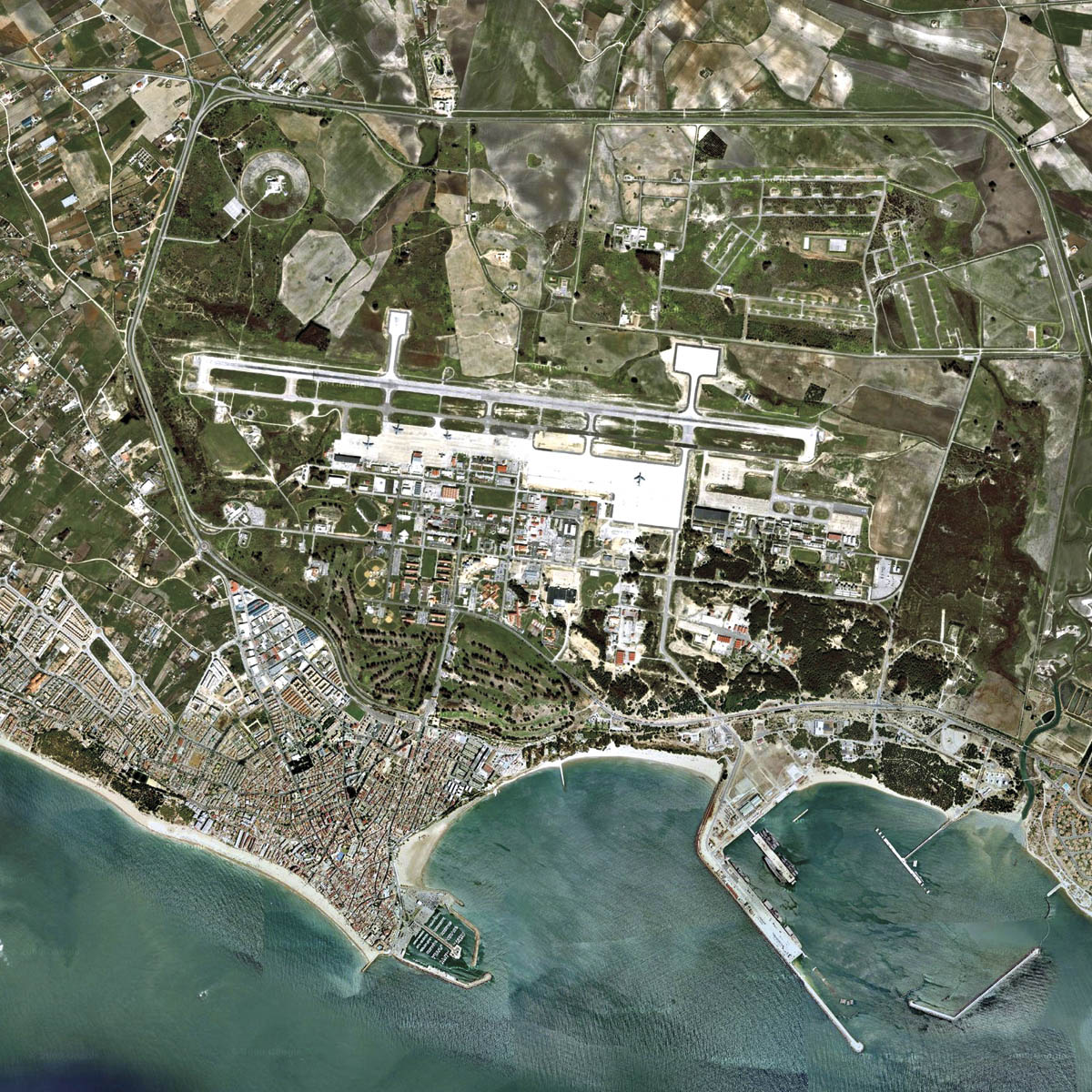
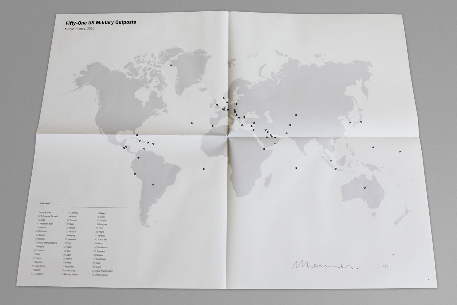
One of my earliest engagements with satellite technology, Fifty-One US Military Outposts marks the beginning of his use of Google Earth as both a research tool and a creative medium. Composed from images gathered in the public domain, the series locates American military bases in fifty-one different countries, many of which were officially unacknowledged or denied. By stitching together these overhead views, I sought to create a new form of documentary practice in which the camera is displaced by global surveillance infrastructures. The project not only exposes the vast reach of U.S. military power but also signals a shift in how artists might work with emerging digital cartographies: appropriating the same tools of vision used by states and corporations to create counter-maps of visibility.
Softcover print-on-demand book, 10x8 inches (25×20 cm), 106 pages
Fifty-one archival pigment prints printed on 310gsm matt textured paper,
presented in a buckram covered clamshell box with a signed and numbered
fold-out map printed on newsprint Fifty-one archival pigment prints mounted to plinths
Prints 15x12 inches (38.1x30.5cm)
Portfolio 16x12.8x1.8 inches (40.5x32.5x4.5cm)
In the years following the invasions of Afghanistan and Iraq, I was trying to understand why the United States and its allies were so heavily engaged abroad. At the same time, I became fascinated by the new perspective offered by satellite imagery: a perspective that governments and corporations were already using to plan logistics and strategy, but which had only just become available to the rest of us.
I started piecing together the locations of American military bases around the world, often using fragments of information scattered across public forums, veterans’ websites, official statements, and news reports. What struck me was how much of this network was effectively hiding in plain sight — denied or unacknowledged at the governmental level, yet visible through the eyes of satellites and the chatter of those who lived or served near them.
This project marked the beginning of my attempt to rethink documentary photography for a new era. Instead of travelling with a camera, I used the same visioning systems deployed by states and institutions. In doing so, I realised I could use their own tools to reveal the scale of military power and to question what it means to ‘see’ documentary evidence today.


TRAILER
PORTFOLIO


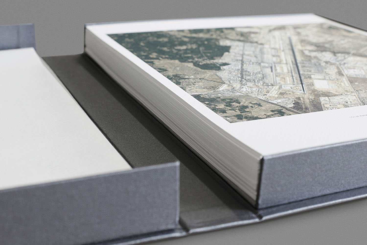
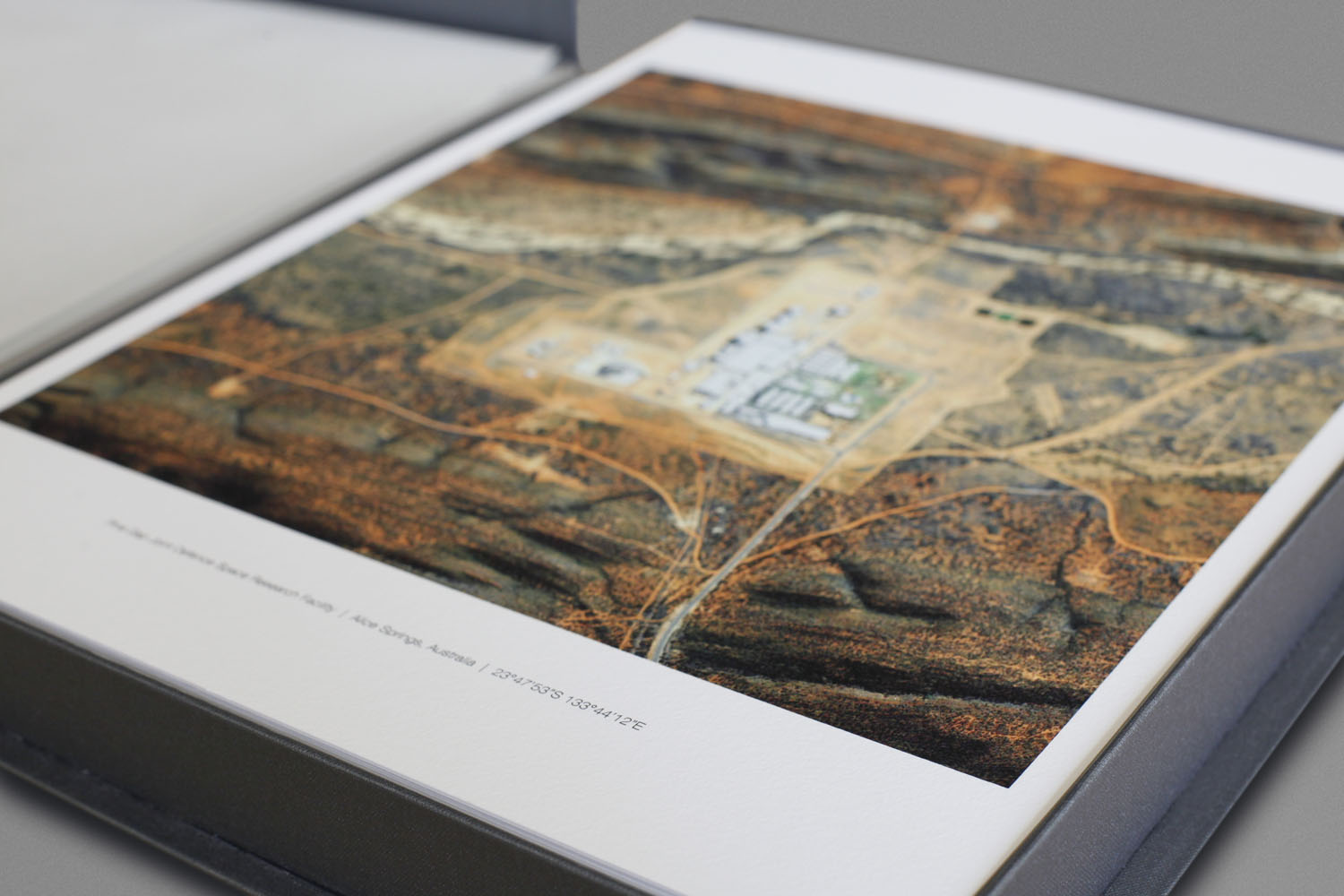
The folio includes fifty one 15x12 inch archival pigment prints printed on 310gsm matt textured paper, presented in a buckram covered clamshell box, dimensions 40.5x32.5x4.5cm with a signed and numbered fold-out map printed on newsprint.
Edition of 5 + 3 APs.
INSTALLATIONS
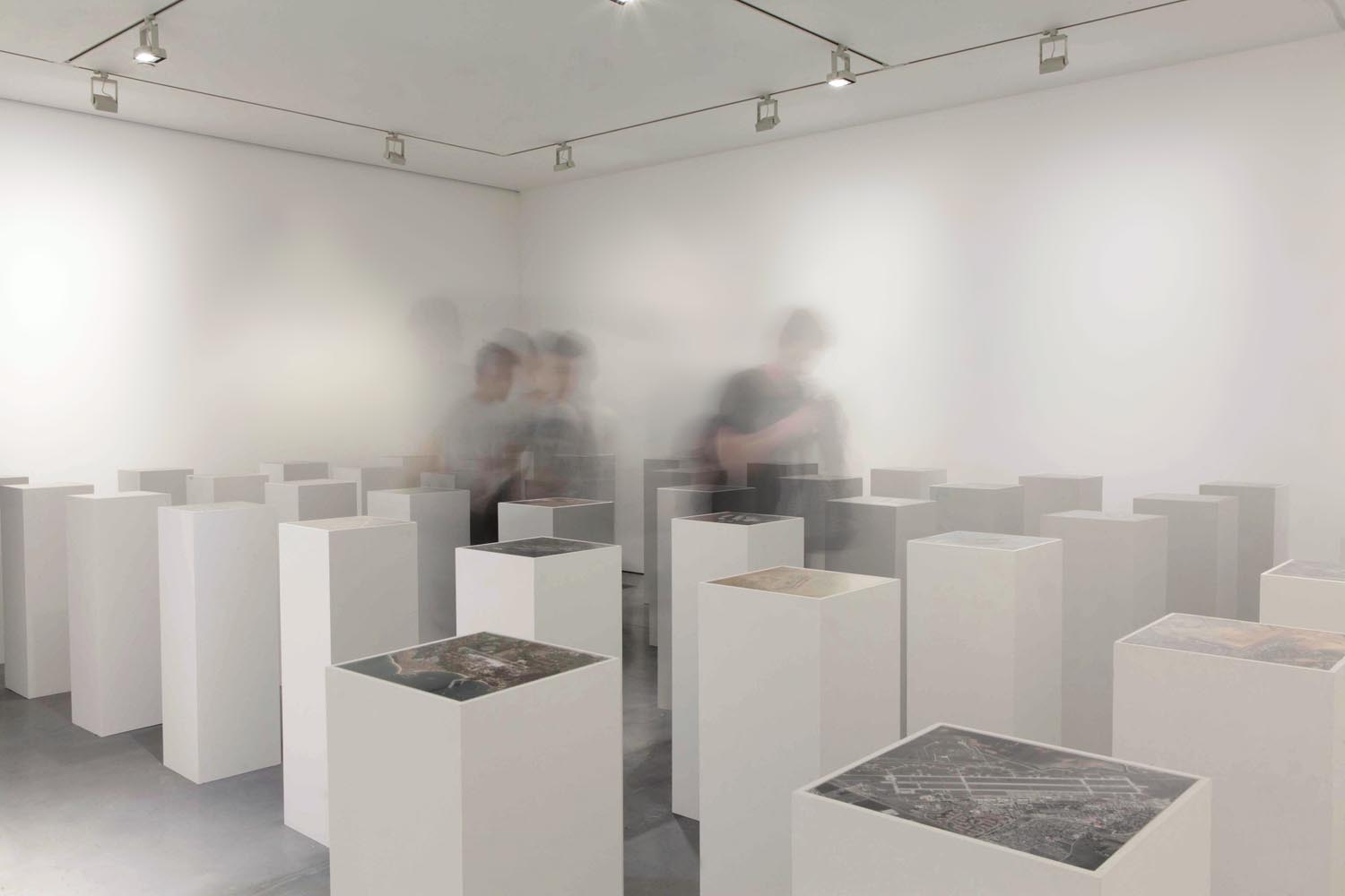


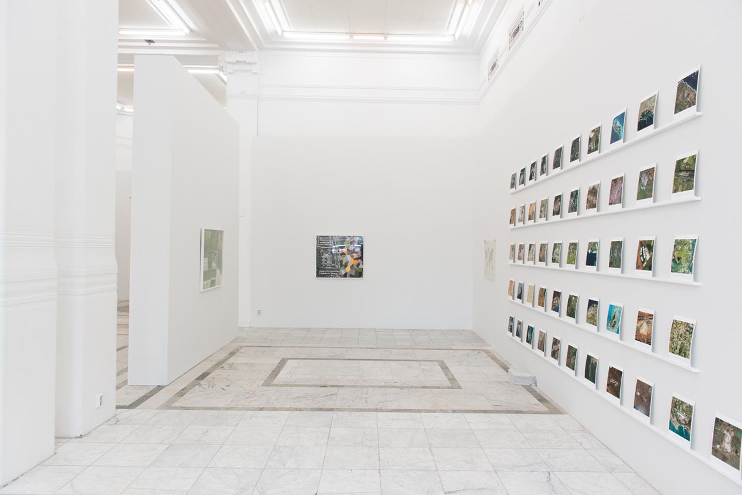
Fifty-One US Military Outposts at Carroll/Fletcher, London, Grundy Art Gallery, Blackpool, and Orebro Kunsthal, Sweden.
SELECTED PRESS


RELATED PROJECTS

DUTCH LANDSCAPES

FIELDS
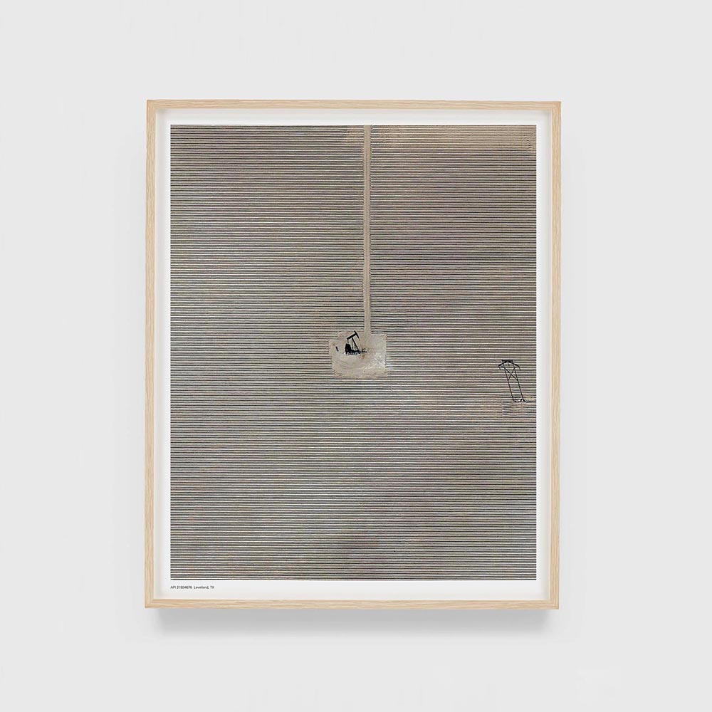
EIGHTEEN PUMPJACKS